Coverage prediction software is nifty and handy, the internet and powerful computers have made the availability of predicting coverage footprints for transmitters and the visible horizon from any location on the globe really easy. A number of simple software packages that let you predict these items are Hey Whats That http://www.heywhatsthat.com/ and Radio Mobile Online http://www.cplus.org/rmw/rmonline.html.
I’ve written before an into to Radio Mobile, and you can see that again here the below is a quick intro to Hey Whats That, it offers similar functions and features to radio mobile, but in its simplest form is just a Line of Sight tool! good for microwave antenna pointing or, its original application, “”Hey, whats that”” lump of dirt in the distance!! Its pretty nifty.
Head to the website and pick your location (you can specify your height above ground (say 12m for your antenna!) I choose a sample one from the lookout at Mt Dandenong and you can see the results below. Choose your location and hit run.
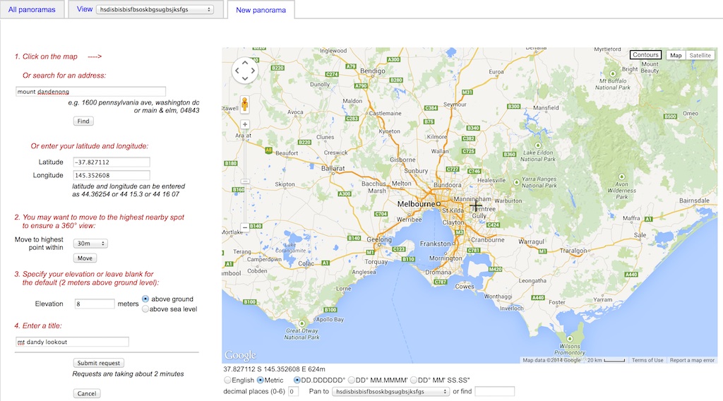
Soon after, the page comes back with the results. At the top shows line of sight view, and a path profiler if you pick a spot on the view

And the map version, the red overlay shows what you can physically see!

One of the options is to export the visibility view into google earth, it downloads the .KML file and lets you see it in that software, it looks like this

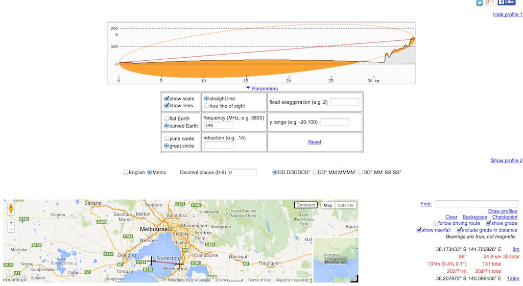
One last feature it offers is a path profiler tool (similar to Radio Mobile) you can choose and A and a B location, even specific a frequency to show you the Fresnel zone expected on the nominated frequency.
My example prediction from Mt Dandenong can be viewed at http://www.heywhatsthat.com/?view=GALT5OP1


